
Introduction
- Global Positioning System (GPS) is a navigation system based on satellite. It has created the revolution in navigation and position location. It is mainly used in positioning, navigation, monitoring and surveying applications.
- The major advantages of satellite navigation are real time positioning and timing synchronization. That’s why satellite navigation systems have become an integral part in most of the applications, where mobility is the key parameter.
- A complete operational GPS space segment contains twenty-four satellites in MEO (Medium Earth Orbit). These satellites are made into six groups so that each group contains four satellites. The group of four satellites is called as one constellation. Any two adjacent constellations are separated by 60 degrees in longitude.
- The orbital period of each satellite is approximately equal to twelve hours. Hence, all satellites revolve around the earth two times on every day. At any time, the GPS receivers will get the signals from at least four satellites.
Background
- The Global Positioning System (GPS) is a satellite-based navigation system that was developed by the U.S. Department of Defense (DoD) in the early 1970s. Initially, GPS was developed as a military system to fulfill U.S. military needs. However, it was later made available to civilians, and is now a dual-use system that can be accessed by both military and civilian users.
- GPS provides continuous positioning and timing information, anywhere in the world under any weather conditions. Because it serves an unlimited number of users as well as being used for security reasons, GPS is a one-way-ranging (passive) system, that is, users can only receive the satellite signals.
- GPS consists, nominally, of a constellation of 24 operational satellites. This constellation, known as the initial operational capability (IOC), was completed in July 1993. The official IOC announcement, however, was made on December 8, 1993.
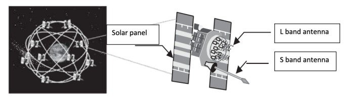
- To ensure continuous worldwide coverage, GPS satellites are arranged so that four satellites are placed in each of six orbital planes (Figure 1). With this constellation geometry, four to ten GPS satellites will be visible anywhere in the world, if an elevation angle of 10° is considered. As discussed, only four satellites are needed to provide the positioning, or location, information.
- GPS satellite orbits are nearly circular (an elliptical shape with a maximum eccentricity is about 0.01), with an inclination of about 55° to the equator. The semi major axis of a GPS orbit is about 26,560 km (i.e., the satellite altitude of about 20,200 km above the Earth’s surface).
- The corresponding GPS orbital period is about 12 sidereal hours (~11 hours, 58 minutes). The GPS system was officially declared to have achieved full operational capability (FOC) on July 17, 1995, ensuring the availability of at least 24 operational, non-experimental, GPS satellites.
- Since GPS achieved its FOC, the number of satellites in the GPS constellation has always been more than 24 operational satellites.
History of the Global Positioning System (GPS)
- 1957 – Soviet Union launched Sputnik I satellite.
- 1960s – U.S. Navy tracked U.S. submarines with satellite navigation.
- 1978 – NAVSTAR Block I GPS satellite was launched.
- 1983 – U.S. announced that it will make GPS available for civilian use after Korean Air flight 007 shot down.
- 1989 – Magellan introduced NAV 1000, the first hand-held GPS device. First Block II satellite is launched.
- 1993 – Constellation of 24 satellite system became operational.
- 1995 – Full Operational Capability (FOC) declared.
- 2000 – Selective Availability discontinued by the U.S. Government.
- 2004 – Qualcomm successfully completed test of live assisted GPS on a mobile phone.
- 2008 – Block II satellite launched.
- 2016 – GPS IIF satellite launched.