Hypsometry (from Ancient Greek (húpsos) ‘height‘ and (métron) ‘measure‘) is the measurement of the elevation and depth of features of Earth’s surface relative to mean sea level.
On Earth, the elevations can take on either positive or negative (below sea level) values. The distribution is theorised to be bimodal due to the difference in density between the lighter continental crust and denser oceanic crust. On other planets within this solar system, elevations are typically unimodal, owing to the lack of plate tectonics on those bodies.
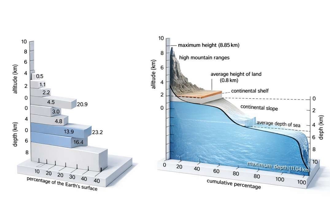
Hypsography of the Earth. Notice that Earth has two peaks in elevation, one for the continents, the other for the ocean floors