Covered Topics: Measurement of Indices, Making Indicators Scale Free, Computation of Composite Index, Principal Component Analysts & Cluster Analysts, Morphometric Analysis: Ordering of Streams, Bifurcation Ratio, Drainage Density and Drainage Frequency, Basin Circularity Ratio and Form Factor, Profiles, Stope Analysis, Clinographic & Hypsographic Curve, Altimetric Frequency Graph.
1. Identify the order of the stream at the section marked ‘X’. (SEP 2013)
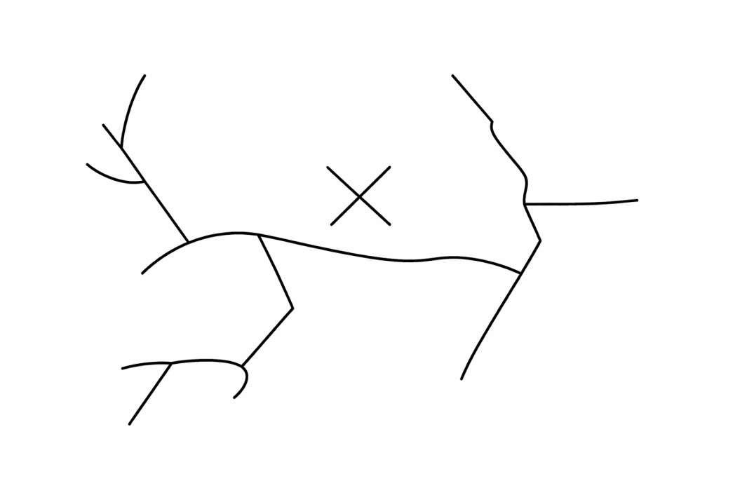
(1) 2
(2) 3
(3) 4
(4) 5
2. On a topographical map of 1:50,000 scale the contour Interval is given as 10 meters. Place’ A’is situated on a contour of 200m MSL and another place ‘B’ is located on a contour of 240 m MSL. The distance between ‘A’ and ‘B’ on the map is 4.0 cm. The correct gradient between ‘A’ and ‘B’ therefore would be: (JULY 2018)
(1) 1/30
(2) 1/40
(3) 1/50
(4) 1/60
3. Which one of the following codes is the correct Rn value of the given distribution of 6 settlements of an area of gentle topography? (JULY 2018)
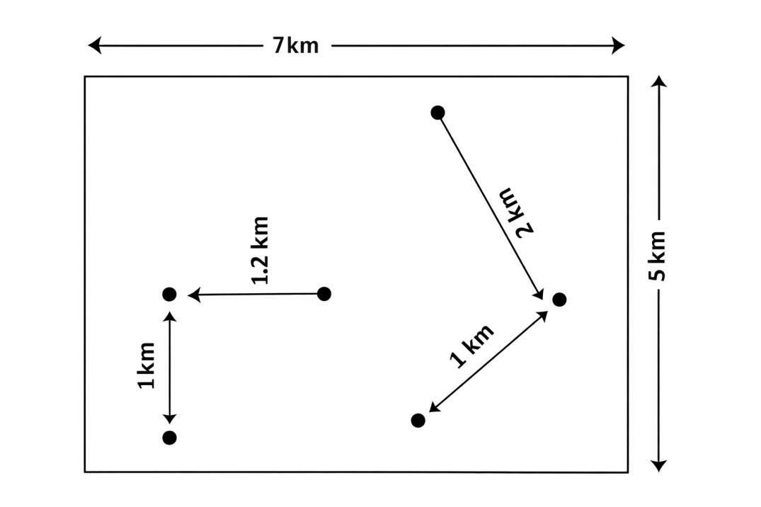
(1) 0.95
(2) 1.45
(3) 1.63
(4) 1.86