
Map Projections
Map projection is a systematic transformation that allows the orderly representation of Earth’s spherical graticules on a flat map. In other sense, it is a transformation of geographic coordinates (latitude, longitude) into the Cartesian (x, y) coordinate plane of the map sheets. It portrays a three-dimensional object, such as the Earth’s globe, in a two-dimensional format.
Map projections, by default, are not true or accurate portrayals of the globe because a two-dimensional plane cannot accurately represent large portions of the rounded, curvilinear surface of the Earth. Fig. 1 illustrates the geographic model and projection, in which you can notice the shapes of different continents and how different they are from each other.
You should note that no projection maintains all the features (i.e. shape, distance, area and direction) in their original form after transformation. Either one or more or all of the above features are compromised based on the type of projection used for transformation.
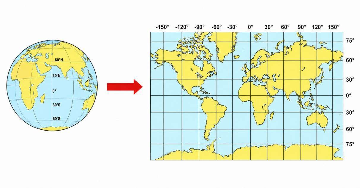
Fig 1. Geographic Model and Projection to Flat Map
To show regions of the Earth on any appreciable area with accuracy, geographic data must be drawn to compromise the distortions of shapes, distances, area and directions introduced by the spheroid.
Construction of Map Projection
Let us now see how a map projection is created. Creation of a map projection involves two steps:
Selection of a model for the shape of the Earth or planetary body (usually a sphere or ellipsoid). You should remember that because the Earth’s actual shape is irregular, some degree of information is lost in this step.
Transformation of geographic coordinates (longitude and latitude) to Cartesian (x, y) or polar plane coordinates.
Some of the simplest map projections may be easily understood when you place a light source at some definite point relative to the globe and project its features onto a specified surface as shown in Fig. 2. However, most of the projections are defined only with the help of certain mathematical formulae and have no direct physical projection.
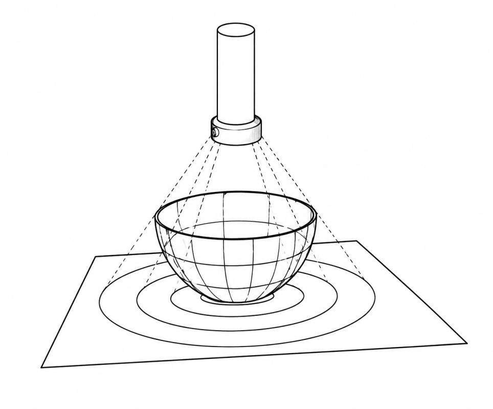
Fig 2. Projection of Earth Graticule onto a Plane through a Light Source