
Introduction
A geomorphic agent is a mobile medium that transports, removes, and deposits earth materials. Running water, glaciers, wind, waves, ocean currents, and groundwater are examples of geomorphic agents. The passive or active action by these Geomorphological agents is a geomorphic process that shapes the earth by creating certain landforms with the help of these agents. When these elements of nature become mobile due to gradients, they remove the materials, transport them over slopes, and deposit them at lower levels.
- Geomorphic agents are natural forces or entities that actively shape the Earth’s surface through processes of erosion, transportation, and deposition.
- These movements take place due to gradients, always from, higher to lower levels or from high pressure to low pressure regions.
- These agents sculpt the landscape, giving rise to various landforms and are instrumental in the continual transformation and renewal of the Earth’s topography.
- Running water, groundwater, glaciers, wind, waves and currents, etc., are examples of geomorphic agents.
- Each geomorphic agent operates uniquely, influenced by factors like climate, topography, underlying geology, and vegetation.
Geomorphic Agents
Groundwater
Groundwater is a significant geomorphological agent. It seeps through cracks in the rocks and moves slowly, pulled deeper and deeper by gravity. If the rock is permeable, such as sandstone, water will easily pass through it. Although the amount of subsurface water varies from location to place, it has a significant effect on forming the earth’s surface features. Its work is mostly limited to subsurface locations, yet it does play a significant role on the surface as well. Geomorphological agent
- The water which percolates inside the earth is called underground water.
- As it rains, rainwater collects carbon dioxide (CO2).
- Carbonic acid is formed when CO2 reacts with water (CO2 + H2O ⇌ H2CO3).
- The slightly acidic water seeps into the earth and travels through soil pore spaces, cracks, and fractures.
- There are two sorts of topographical landforms formed by subsurface water working on limestone.
- Surface topographical features such as sinkholes and swallow holes.
- Underground topographical features such as caverns, stalactites, and stalagmites.
Erosional Landforms Formed Due to Groundwater:
Sinkholes:
- A sinkhole is a depression in the ground caused by limestone or chalk region erosion.
- It is a circular or funnel-shaped opening at the top and funnel-shaped at the bottom.
- They form where the limestone is more prone to the solution, weathering, or where an underground cover near the surface has collapsed.
- These holes are formed by the widening of fissures occurring in such rocks as a result of rainwater’s continual solvent action.
- A solution sink is a sinkhole that has formed purely via the process of solution.
- Some sinkholes are steep-sided dug holes filled with earth washed down from nearby hillsides.
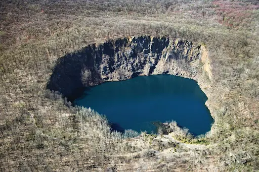
Sinkhole
Swallow Holes:
- They are cylindrical in shape and are found at a depth beneath the sinkholes.
- Surface streams frequently enter sinkholes in limestone environments and then disappear underground through swallow holes because these openings are connected to the subsurface caverns on the other side.
- Following are some examples of sinkholes/swallow holes:
- Blackhole – Seawater
- Blue Hole – Deep underwater
- Cenotes – Belize (British Honduras)
- Sotanos – Mexico
- Tomo – New Zealand
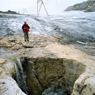
Swallow Hole
Doline:
- In karst regions, a doline is a closed depression that drains underground.
- It might be formed like a cylinder, a cone, a bowl, or a dish.
- The diameter varies greatly, from a few meters to hundreds of meters.
- Doline is derived from the Slovenian term Dolina, which means valley.
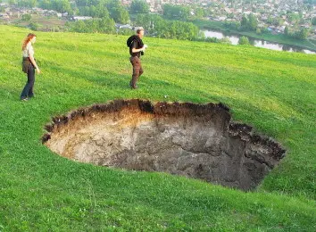
Doline
Karst Window / Fenster:
- A geomorphic feature generated by the dissolving of carbonate bedrock is known as a Karst Fenster.
- A spring rises from this feature, and the discharge disappears into a sinkhole.
- A Karst Fenster is formed when segments of a subterranean stream’s roof cave in, exposing some of the subsurface streams to the surface.
- A Karst window is formed when many adjacent sinkholes collapse and form an open, broad space.
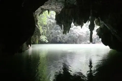
Karst Window
Lappies/Karren:
- Lappies are uneven grooves and ridges that occur after the majority of the surface of the limestone is removed by the solution process.
- The most widespread surface karst landforms are small solution pits, grooves, and runnels, collectively called Karren.
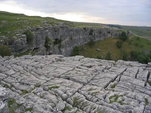
Karren
Uvala:
- Uvalas are karst depressions that are significantly larger than sinkholes, with smoother slopes and more interesting three-dimensional formations.
- Collection of multiple smaller individual sinkholes that coalesce into a compound sinkhole.
- A single uvala usually contains a number of sinkholes.
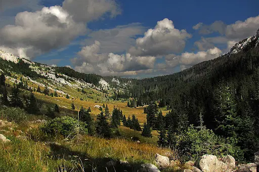
Uvala
Polje:
- The Polje basin is a long, narrow basin with a level bottom and steep cliffs. It is the result of the merging of many sinkholes.
- The basins are typically 250 square kilometers in size and might show “disappearing streams.”
- The majority of these basins have steep enclosing walls that range in height from 50 to 100 meters, earning the term “blind valley.”
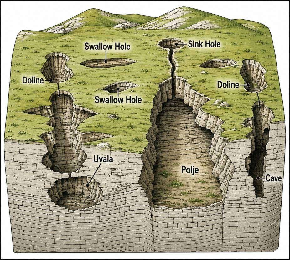
Different landforms formed by the action of underground water
Caves:
- Cave streams are generally discharged through an aperture in the cave.
- Tunnels are caves that have an aperture on both ends.
- The dissolution process produces a distinctive landform known as karst, characterized by sinkholes and underground drainage.
- Cave formation is common in locations with alternating beds of rocks (shales, sandstones, quartzites) with limestones or dolomites in between, or where limestones are dense, massive, and occur as thick beds.
- Limestone caves are often adorned with calcium carbonate formations produced through slow precipitation.
- These include flowstones, stalactites, stalagmites, helictites, soda straws, and columns.
Depositional Landforms Due to Groundwater:
Curtains/Drapes:
- Rainwater drips from a cave roof’s lengthy fracture, forming a continuous strip of calcites.
- Numerous needle-shaped dripstones hanging from the cave ceiling are called Drapes or Curtains.
Stalactite:
- Water drops containing dissolved limestone trickle down via cave roof fractures.
- Water drops expel carbon dioxide and deposit calcite.
- Calcite pillars hang from the cave’s roof as calcite deposits accumulate over time.
- Usually, the base is broader than the free end of the hanging stalactites.
- It’s known as stalactite, and it’s known as helictites when the stalactite stretches to the sidewalls.
Stalagmite:
- Stalagmite is the formation of calcite icicles that rise upward from the cave floor.
- Stalactites are calcium carbonate deposits that hang like icicles from the ceiling.
- Whereas stalagmites are calcium carbonate deposits that rise from the ground.
- Halagmites are those that stretch horizontally or diagonally from stalagmites.
Pillar:
- A pillar is formed when both a stalagmite and a stalactite connect together.
- The diameter of the pillar varies.
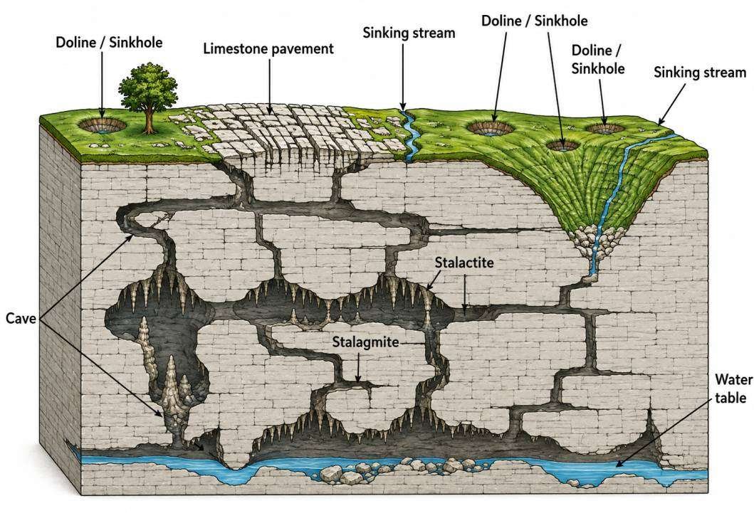
Depositional landforms